

Payment & Security
Your payment information is processed securely. We do not store credit card details nor have access to your credit card information.
Description
Map 6: WesternPort Map includes over 150 GPS marks.
Waratah Bay
Shallow Inlet
Andersons Inlet & Venus Bay
Tear and water resistant fishing map
Product Specifications
- Format: Sheet Map
- Language: English
- Published: 31st October 2008
| Length : 25 cm | Width : 17.5 cm |
| Height : 0.3 cm |


Easy Returns
Free 365 Day Warranty

Shop & Pay in your currency
Now shipping to 40+ countries

100,000+ Products
Amazing Brands. All Gift Occasions.
Related Products
Top Selling Items


Trending Products


LatestBuy
Double A A4 Copy Paper 100gsm 200pcs (White)
Sale price83.99 kr
In stock
🛒
KÖP MER SPARA MER!


My Hero Academia
My Hero Academia Katsuki Bakugo US Exclusive Pop! Vinyl
Sale price232.99 kr
In stock
🛒
KÖP MER SPARA MER!

Save 14%
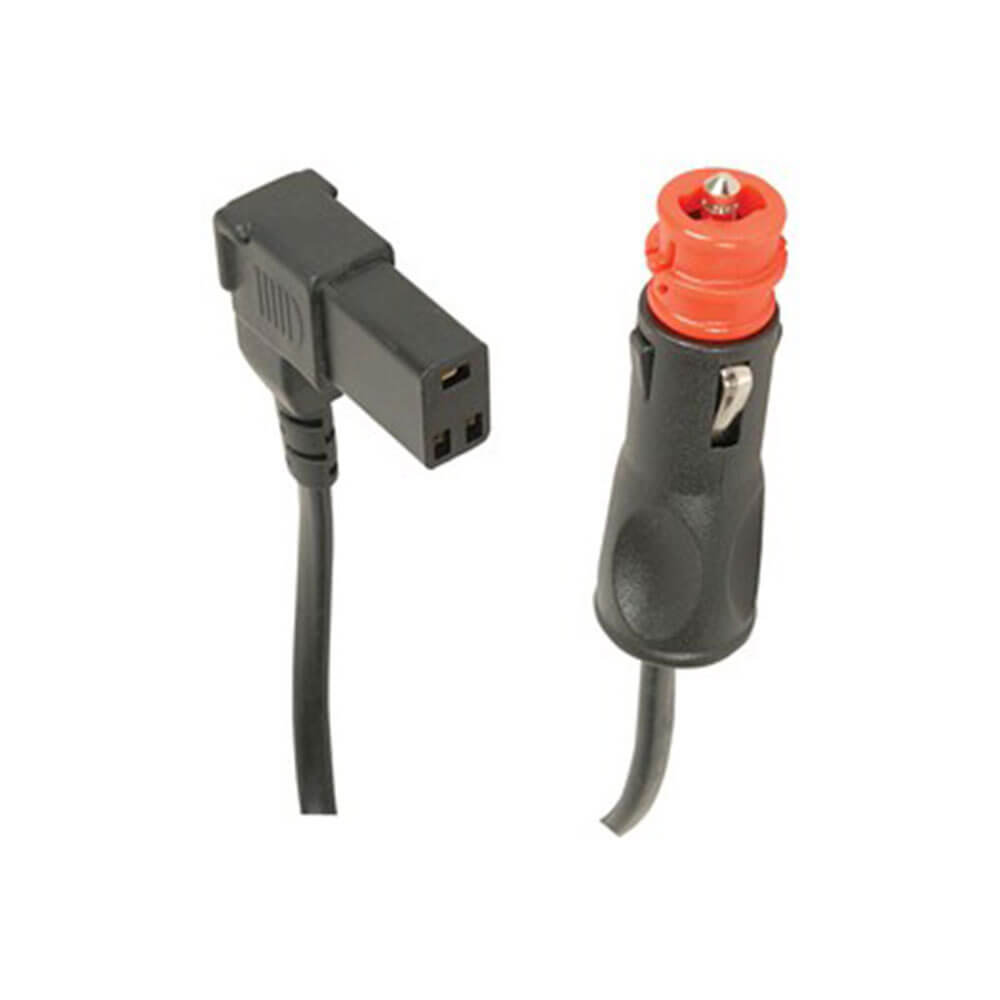
Jaycar
Replacement Cable with 3 Pin Socket for Engel Fridges 8A
Sale price282.99 kr
Regular price327.99 kr
In stock